
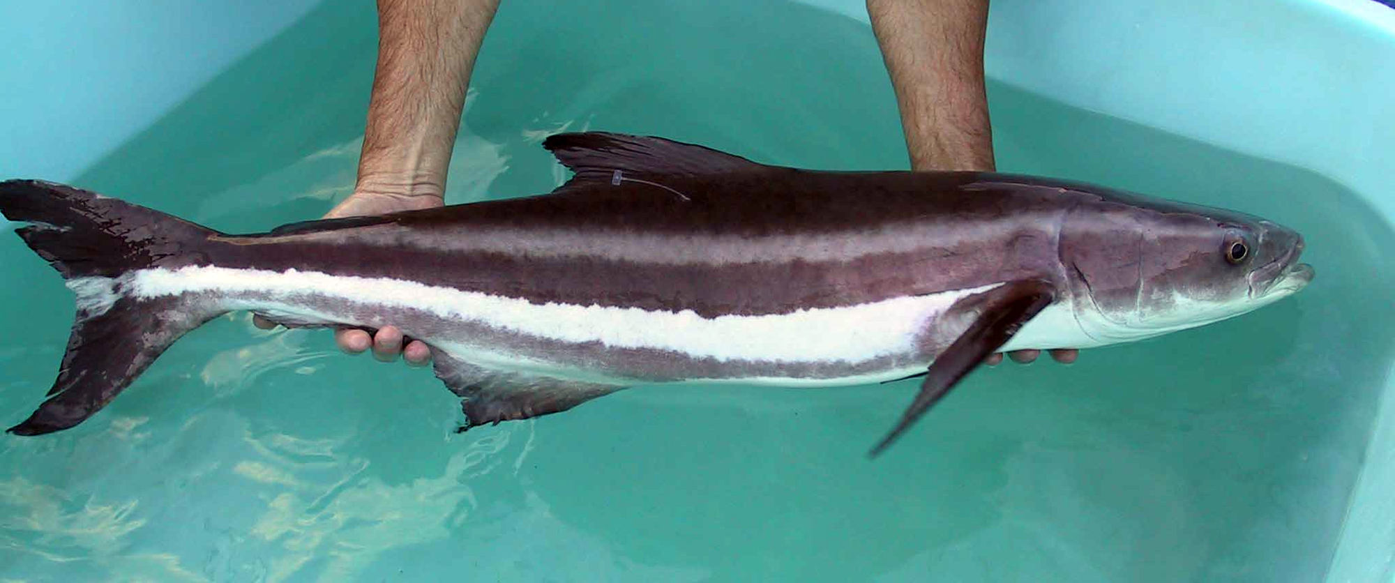
This week on the Chesapeake, it is cobia season in the truest sense — sight-fishing weather, brown fish cruising the surface, and a lower bay full of boats with towers scanning the slicks.
What’s Hitting
Cobia are the headline in the lower bay, with fish being caught both by the sight-casting fleet and the chummers anchored on the traditional grounds. Spot and croaker are filling the bottom rigs in the rivers and along the channel edges, speckled trout are around the islands and grass beds, and Spanish mackerel are streaking through the mid-bay on the surface. Sheepshead are holding at the CBBT pilings.
Where to Find Them
The stretch from the CBBT up to the Rappahannock is holding cruising cobia — flat light and clean water make the sight game work. Chummers are setting up off Bluefish Rock and the lumps near the York Spit. Spot are thick in the lower rivers, and the specks are on the grass around Gwynn’s Island and the Poquoson flats.
Tides & Conditions
Light morning winds and hazy-bright skies are decent sight-fishing conditions. Bay water temperatures are in the low 80s, and clarity in the lower bay has been good between blows. The afternoon southerly puts a chop on things by mid-day.
Tackle & Tactics
Sight-cast cobia want a big bucktail with a curly-tail trailer or a live eel pitched well ahead of a cruising fish. The chunk-and-chum crowd is fishing cut bunker on fish-finder rigs. Spot and croaker take bloodworms or Fishbites on two-hook bottom rigs, and the specks are eating soft plastics under corks along the grass.
Local Intel This Week
The Lynnhaven ramp in Virginia Beach, Messick Point in Poquoson, and the Gloucester Point ramp at the York River mouth are the main public launches for the lower bay. Fish are concentrating on the lower-bay cobia grounds and the river channel edges. Cobia seasons and size rules are specific and enforced — check current Virginia regulations before keeping fish.
Spots & Access This Week
The lower bay is well served by public ramps. Lynnhaven Municipal Marina and the Owl Creek ramp in Virginia Beach both handle trailers well and give quick access to the Chesapeake Bay Bridge-Tunnel islands. The Messick Point ramp in Poquoson is the practical launch for the flats and the York Spit, and the Sunset Boulevard ramp serves the Lynnhaven system for anglers working the inlet and the creeks. Farther up the bay, the Sandy Point State Park ramp in Maryland and the Kent Narrows ramps give access to the mid-bay structure. Shore anglers do well from the CBBT fishing pier area and the Lynnhaven Inlet bridge. Every lower-bay ramp is busy on summer weekends, and the sight-casting fleet leaves at first light.
Structure, Bait and the Sea Breeze
The Chesapeake in midsummer is a structure fishery layered on top of a bait fishery. The pilings of the CBBT, the rock islands, the shoal edges and the grass lines all hold fish, but only where bait is present that day. Idle and look at the sounder before you commit — an island that produced last week can be empty this week if the bait moved. The other governing factor is the sea breeze. Flat morning water is what makes the sight-casting possible, and it typically ends between ten and noon. Once the chop is up, shift to a chum slick over a shoal or drop down to the pilings and work vertically. The fish do not leave when the wind comes up; you just have to change how you find them.
This Week’s Tip
Sight-fishing cobia is a sun-angle game. Run with the sun behind you between ten and two, idle down when you spot a fish, and lead it by twenty feet — a bait landing on a cobia’s head sends it down, but one crossing its path gets crushed.
More Chesapeake Bay Resources
Chesapeake Bay Fishing Guide · Chesapeake Bay Seasonal Calendar · All Chesapeake Bay reports →
Also read: Chesapeake Bay Fishing Report — Week of July 30, 2026: Cobia Sight-Casting, Speckled Trout
Reports updated every Thursday on fishing.digital.
Planning a trip to Chesapeake Bay?
This report tells you what happened. ReelAI tells you what to do about it — a briefing for your date, your target species and how you're fishing, built from our reports plus live NOAA and USGS data.
Powered by ReelAI — fishing.digital's intelligence layer. Answers are generated from fishing.digital reports and public NOAA, NWS and USGS data, and may be incomplete or out of date. Regulations and marine safety information are summaries only; always confirm with the responsible authority before you fish.