
Updated: Thursday, November 5, 2026 · Next update: Thursday, November 12, 2026
The Jacksonville fishing report for the week of November 5 is a seasonal outlook drawn from the typical First Coast pattern, not a record of this week’s catches. Early November should bring cooler air, the fall mullet and shrimp movements out of the St. Johns River and marshes, and strong tides near the new moon on Monday, November 9. Mornings now arrive earlier after the clock change.
What’s Hitting
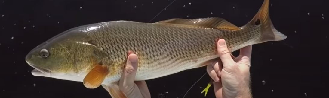
Redfish should be a staple, with schools often gathered along marsh edges, the ends of jetties and the beaches near the inlet. Fall brings a pompano push along the surf in many years, and anglers working sandy troughs with small jigs or sand fleas commonly find them. Bluefish and Spanish mackerel may linger near the beaches and the inlet when bait is present, though they usually thin out as water cools. Speckled trout tend to gather in deeper creek bends and holes, and flounder often remain active near the inlet edges. Sheepshead start to arrive around pilings and rocks as temperatures drop. Wind and front timing influence the surf, so calmer days after a cold front tend to be the most comfortable.
Where to Find Them
The Mayport and St. Johns River mouth area is the premier structure on the First Coast, with jetties, pilings and sandbars that concentrate bait. North, Nassau Sound and the Talbot Islands offer marsh and creek fishing. South of the river, the Jacksonville Beach surf and the Guana River area provide long stretches of trough fishing. Inside the marsh, creeks near Fort George and the Intracoastal Waterway hold redfish and trout. Offshore trips depend on weather and the usual fall northeast wind pattern, which can stack seas against the outgoing current at the inlet.
Tides & Conditions
The inlet and the lower St. Johns have powerful tidal flow, and the new moon on Monday, November 9 should strengthen it for several days. Anglers heading out of Mayport should treat the outgoing tide with respect, especially in a stiff easterly wind. In the marsh, a falling tide often pulls bait and redfish toward creek mouths and oyster bars. For the surf, a rising tide helps bring pompano into the troughs. Always check a tide chart for the Mayport Bar Pilots station and keep an eye on the wind forecast before you depart.
Tackle & Tactics
For surf pompano, a nine-foot spinning rod, ten-pound braid, a fluorocarbon leader, and a pompano rig with small hooks baited with sand fleas or fresh shrimp is a classic setup. Small pompano jigs in pink or yellow are a good alternative. Redfish anglers can rely on a seven-foot rod, a paddle-tail soft plastic, or a live mullet on a Carolina rig. For bluefish, bring a few wire leaders or heavy fluorocarbon to avoid cut-offs. Keep a cooler with ice if you plan to keep fish, and wear sun protection even on cooler days.
Local Intel This Week
Local public access is plentiful. Jacksonville Beach Pier is a long-standing oceanfront fishing pier and a good place to find advice from regulars. Kathryn Abbey Hanna Park has a beach and nearby jetty-adjacent areas, and Little Talbot Island State Park offers surf and marsh-edge fishing in a beautiful setting. Another option is the Mayport area’s public boat ramps for those with small vessels. Weekend crowds can fill parking lots by midmorning, particularly at the beach lots, so aim for an early arrival. Pier fees and hours vary by season, so confirm them locally. State parks charge day-use entry, and rangers can explain the current beach rules for surf casting and vehicle access. Mayport ramps get busy on calm weekends. Check current state and federal regulations and seasons before keeping fish.
This Week’s Tip
Walk the beach near Jacksonville Beach Pier at low tide this week and look for the troughs and sandbars that will hold fish. Return on the rising tide with sand fleas and a pompano rig, and cast just beyond the trough.
Planning a trip to Jacksonville?
This report tells you what happened. ReelAI tells you what to do about it — a briefing for your date, your target species and how you're fishing, built from our reports plus live NOAA and USGS data.
Powered by ReelAI — fishing.digital's intelligence layer. Answers are generated from fishing.digital reports and public NOAA, NWS and USGS data, and may be incomplete or out of date. Regulations and marine safety information are summaries only; always confirm with the responsible authority before you fish.